-1000x1000.jpg)
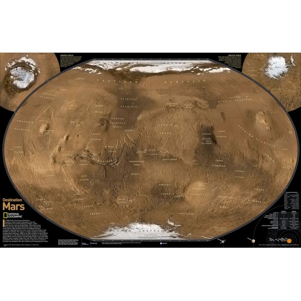
Plansch Mars the Red Planet från National Geographic. OBS! Planschen är dubbelsidig. Format: 79x51cm. Engelsk text.
A National Geographic exclusive, this dual-sided map is an amalgamation of almost 1,000 images taken from the Mars Global Surveyor satellite. It provides the sharpest rendering yet of Mars and its terrain.
Over 18 insets illustrate the past and present geography and landscape of Mars including evidence of: daily surface changes from wind, ice, and possibly water; past catastrophic floods; and massive volcanic activity with lava flows larger than the area of Russia! A timeline reveals our fascination with Mars, and our efforts to describe it with scientific exploration and Hollywood fantasy.


